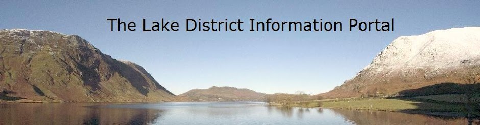
Grasmere's position at the hub of the English Lake District, as well as its connections with the Lake Poets, has made it extremely popular as a tourist destination. William Wordsworth, who lived in Grasmere for fourteen years, described it as "the loveliest spot that man hath ever found"
The village is overlooked by the small rocky hill of Helm Crag, more commonly known as The Lion and the Lamb or the Old Lady at the Piano, depending on which side you are viewing it from. These names coming about from the shape of rock formations on the summit.
The A591 connects Grasmere northwards over Dunmail Raise to the Vale of Keswick and in a southerly direction to Ambleside.
Grasmere's legendary Rushbearing Ceremony has ancient origins. The present day ceremony is an annual event which comprises of a procession through the village with bearings made from rushes and flowers. In this procession there are also six Maids of Honour, a brass band, the church choir together with anyone who wishes to join in by carrying their own decorated rushbearing.
In August, Grasmere holds Grasmere Sports which have been carried out since 1852. This is the main event in Grasmere's calendar and one of the most popular traditional events in all of the Lake District. Some of the numerous events at Grasmere Sports include Cumberland Wrestling, fell running and hound trails.
The former civil parish was for a time governed by an urban district council before it later became part of the Lakes UDC in 1934. The village is now considered as part of Lakes parish. Grasmere has experienced population decline over the last fifty years.
William Wordsworth resided in Dove Cottage, in the hamlet of Townend, just on the outskirts of Grasmere, from 1799. He occasionally used to breakfast with Sir Walter Scott at The Swan, a delightful seventeenth century coaching inn that is still in use in the village.
In his poem "The Waggoner", Wordsworth asked the question "who does not know the famous Swan" a line which is quoted on the Swan's pub sign to this day. In 1808 he sold Dove Cottage to his friend and acquaintance Thomas de Quincey and moved to a much larger house in the village, Allan Bank, where he lived until he moved to Rydal Mount, Ambleside in 1813. He is buried in the graveyard of St. Oswald's Church, Grasmere, with his wife, Mary and their family.
His sister, Dorothy, is also buried there alongside him. Samuel Taylor Coleridge also passed time at Dove Cottage and is said to have spoken stanzas from his poem "The Rime of the Ancient Mariner" whilst walking across the fells to Grasmere.
Sarah Nelson owned the original shop and was maker of the famous Grasmere Gingerbread, which is a secret recipe. The shop is next to the village centre in a tiny house, which was the village school, alongside the church.
Reference: Wikipedia - under the GNU Free Doc Licence
Grasmere
Broughton-in-Furness
Situated on the southern edge of the Lake District National Park in Cumbia is the small town of Broughton-in-Furness which until 1974 was still a part of the county of Lancashire. It is close to the River Duddon, being inland from the coastal hamlet of Foxfield.
The town dates back to the 11th century and indeed the original settlement grew in size to become the prevalent market town both for agriculture and fishing.
In 1810 an obelisk was constructed in the centre of the town square marking the Silver Jubilee of King George III.
The Coniston branch of the Furness Railway was routed through the town from 1859, for almost a hundred years, until it was shut and dismantled in 1958, leaving Broughton's closest station being on the coast at Foxfield.
Tourism, despite the creation of the National Park in the ninteen fifties, still tends to focus further north and east. The rural feel of the town was improved during the 1990's with the diversion of the A595 road.
The town square in Broughton is home to the famous restaurant, Beswick's, so called after Joyce and Ian Beswick, who formed the restaurant in one of the fine examples of Georgian property surrounding the square and noted for its prime cuts of meat from Berkshire Boar and Galloway Cow. In addition the Broughton Village Bakery holds the good food award, not least because of its specialisation in predominantly organic produce.
Source: Wikipedia - under the GNU Free Doc Licence
Ulverston

Ulverston is connected to the rest of the world by the Ulverston Railway line which is located on the Furness Line from Barrow-in-Furness to Lancaster. This line ultimately leads to the Manchester Airport. The railway station is just a few minutes’ walk from the centre of the town.
The Hoad Monument which was built in 1850 is a concrete structure and is one of the most distinguishing features of Ulverston. It was built to commemorate statesman and local resident Sir John Barrow. The monument provides amazing views of the scenic areas that surround Ulverston – Morcambe Bay and the Lake District.
The deepest, widest and shortest canal in the United Kingdom measuring 1¼ miles is the Ulverston Canal. It is no longer in use but at one point in time it served as a vital component of the town’s economy.
The Market Street is the main street in Ulverston. The cobbled ways of this street house a number of shops and pubs. At the head of the Market Street is a World War Memorial which is dedicated to the local soldiers who laid their lives down during the World War I.
Festival town:
Ulverston rightly prides itself in being called the ‘Festival Town’. This is because of the many different and varied festivals that take place in Ulverston throughout the year. The most famous of these festivals is the Lantern Procession which involves hundreds of locals carrying lanterns that are made of willow and tissue paper and carry them in a parade throughout the town. It is such a wonderful display of winding light. This event ends with a display of theatrical performances and fireworks in Ford Park. This Lantern Procession was completely organized by the community in an indigenous way and it took place for the first time in 2007.
Staveley
Historically Staveley was in the county of Westmorland. In 1974 Staveley became part of the metropolitan county of Cumbria. This scenic village is in a strategic location at the confluence of the rivers Kent and Gowan at the mouth of the Kentmere valley.
There are three beautiful hills that overlook and adorn the village. To the northern side is Reston Scar on which most of the village of Staveley is built. To the north eastern side is Piked Howe (known as Craggy Wood to the locals). To the southern side is Lily Fell in the direction of the village of Crook (opposite side of A591 bypass). Both Reston Scar and Piked Howe are on either side and open into the Kentmere valley. They mark the start of a very large horseshoe chain of hills and hillocks popularly known as the Kentmere Round.
Ings is a nearby village which is mostly a small settlement and it shares schools and parish minister with Staveley. To the south of the village is Crook and to the north Kentmere which can be accessed only by passing through the centre of Staveley village. Because of this both Kentmere and Staveley villages have had a close relationship by means of trade and lifestyle. In the recent years another village has had a close relationship with Staveley. It is Burneside which is the next stop on the eastern train line on the way to Kendal. The availability of connectivity by means of the train line ensured that a lot of trade and industry passed through these two villages. This helped the villages grow in status and they flourished alongside and increased contact with each other.
Source: Wikipedia - under the GNU Free Doc Licence
Penrith
photo by Dave Cross

Penrith is a quaint little market town in Cumbria, Northwest England. It is located in the Eden Valley, just north of the river Eamont and is less than 5 kilometres outside the borders of the Lake District National Park. Other rivers that run through the town are River Lowther and River Petteril. A manmade watercourse Thacka Beck flows through the middle of the town and connects the rivers Petteril and Eamont. For years down the line, Thacka Beck has been the main source of water supply for the people of Penrith.
Penrith does not have its own town council. It is the least populated area without a parish only next to Berwick-upon-Tweed. Penrith was historically a part of Cumberland. The local administrative authority however is the Eden District Council which is based in Penrith. This was originally the seat of both the Penrith Urban and Rural District Councils.
St. Andrew’s is the main church of Penrith and was built in the 17th century from 1720 to 1722 in a Grecian style of architecture. It abuts a 13th century tower. The churchyard is home to many ancient crosses and hogback tombstones. These are now known as the “Giant’s Grave” and “Giant’s Thumb”. These are actually the remains of a Norse cross which dates back to 920 AD.
The ruins and remains of the Penrith Castle (dated 13th to 15th century) can be seen from the adjacent railway station. The ruins have been declared as a heritage site and are being run as a tourist attraction by the English Heritage. More ruins of the Brougham Castle which are also being maintained by the English Heritage can be seen in the south east of Penrith.
There are ancient “henge” sites to the south of the town. They are referred to as the “Mayburgh Henge” and “King Arthur’s Round Table”. Both these are being protected by the English Heritage.
The Clock Tower in the centre of the town which was erected in 1861 as a dedication to Philip Musgrave of Edenhall is another popular attraction amongst tourists.
There are a number of wells in and around Penrith for which the town is famous.
There are also a number of festivals and well-dressing ceremonies that take place in May. “Giant Caves” which is three miles south-east of Penrith on the River Eamont is home to a well which was built to commemorate St. Ninian. The caves were carved out of Lower Permian sandstones and their breccias and purple shale.
Beacon Hill is another popular attraction. It is a wooded signal-beacon hill to the north of Penrith. Studies suggest that it must have been used last in 1804 in the war against Emperor Napoleon. The Beacon Pike served as a watchtower to warn any danger being posed from Scotland. Lowther Estates owns the commercial woodland that surrounds the area today. However the hills do contain natural woodlands and these are very popular among tourists and visitors. On a clear day one can see the Eden Valley, the adjoining fells, Pennines and parts of North Lakes. A look at the scenery along with Beacon Hill will justify the name of Penrith. (The name is derived from the Celtic Language in which Penrith means “red hill”).
Source: Wikipedia - under the GNU Free Doc Licence
Hawkshead
photo by binaryape
Located in a serene setting to the west of Windermere and east of Coniston Water is Hawkshead. Hawkshead is just north of Esthwaite Water. It is also part of Furness thus making it an integral part of old Lancashire but its administrative policies are now governed by Cumbria.
History
The township of Hawkshead was initially owned by the monks of Furness Abbey. It was essentially ruled by the monasteries. The Colthouse which is close by derives its name from the stables owned by the Abbey. During the medieval times Hawkshead was the centre of wool trade. The Monasteries were dissolved in 1532 and since then Hawkshead has been a market town. King James I granted the first market charter to this town in 1608. Archbishop Edwin Sandys of York established the first Hawkshead Grammar School in 1585. This was only after he successfully petitioned Queen Elizabeth I to establish a separate governing body for the town of Hawkshead.
During the 18th and 19th centuries Hawkshead gained fame through the literary personalities that inhabited this town. The famous poet William Wordsworth was educated in the local grammar school and Beatrix Potter lived close by. She was later married to William Heelis, a local solicitor.
Traditional farming is still carried on in Hawkshead. The town looks frozen in time with its serene atmosphere, alleys that elude a lot of character, overhanging gables and a series of medieval squares. It is a must visit for those tourists looking to savour the countryside of England. William Wordsworth eloquently describes this town in ‘The Prelude’. The National Park was opened in 1951 and since then the tourism industry has begun to flourish.
The majority of the land in and around the town is owned by the National Trust. The National Trust Property is called Hawkshead and Claife.

Source: Wikipedia - under the GNU Free Doc Licence
Coniston
photo by andyrob

Coniston is a quaint village in Furness. It is located in the south of the Lake District National Park between Coniston Water and Coniston Old Man.
Geography and administration
Coniston has always been within the limits of the Lancashire County since 1182, it was part of the administrative county of Lancashire between 1889 and 1974.
Today Coniston is a part of Cumbria. Coniston is at the head of the Coniston Water, the third longest lake in the Lake District.
History
The village of Coniston grew in popularity both as a farming village and also as home to the local copper and slate mines. It was during the Victorian regime that Coniston became a tourist location mostly due to the fact that a branch of the Furness railway was constructed. The railway line was opened to passenger traffic in 1859 and the line ended at Coniston Railway Station. The popular poet and social activist John Ruskin also brought the name Coniston to news headlines when he bought the Brantwood mansion by the shores of the Coniston Water in 1871. He had is heart so much at Coniston that he chose to be buried in the churchyard of St. Andrews at Coniston than being laid at rest at the famous Westminster Abbey.
Coniston has also found its place in movies. In the animated movie “The Plague Dogs”, two dogs are shown to escape from the fictional Lawson Park vivisection research location.
Present day Coniston
Today Coniston is a popular spot among those who fancy hill climbing, trekking and rock climbing. There are wonderful walks to be had on the Furness Fells and Grizedale Forest which are close by. There are some fine rocks to climb in the Lake District on the eastern face of Dow Crag which is about three miles from Coniston.
A national park was created in the 1950s and that gave a tremendous push to the tourism scene of Coniston. There are more attractions such as the John Ruskin Museum. There are also ferry services which ply across the lake. Donald Campbell brought more fame and glory to this village when he broke the world water speed record in 1967 after beating his own previous best record at the same lake. The sad part was that in the course of breaking his own record he drowned and died. His body and the famous boat – The Bluebird were discovered years later by divers in 2000 and he was buried in 2001 in a graveyard situated in the outskirts of Coniston.
If you are planning to visit Coniston, you can stay at the hotels in the village or the two Youth Hostels – one is at the end of the village and the other one is at the Coppermines Valley.
A couple of slate quarries are still in operation at Coniston, one in the Coppermines Valley and the other at Brossen Stone which is on the east side of Coniston Old Man.
The volcanic slates of Coniston are blue at Low-Brandy Crag in the Coppermines Valley and are light green at Brossen Stone.
Coniston won the Village of the Year award in 1997. It is an important local centre and is complete with a secondary school, bank, petrol station and several other amenities.
The Volcanic rocks from Coniston Limeston and Borrowdale add to the scenic beauty of Coniston.
Source: Wikipedia - under the GNU Free Doc Licence
Ambleside
photo by zoer
Ferries that run from Bowness-on-Windermere and Lakeside offer fantastic views of the lake and the adjacent mountains. Ambleside is a favourite spot amongst hikers and those interested in mountaineering and mountain biking.
A fort beside Borrans Park named Galava was built by the Romans in AD79 to thwart the invasion of Picts and Scots.
Many famous authorities of literature and arts have been associated with Ambleside, including William Wordsworth, Hardwicke Rawnsley, John Ruskin and Beatrix Potter. More about these people can be found in The Armitt Library and the Armitt Museum which is right opposite the main car park entrance.
Ambleside has the unique distinction of having two town charters; one republican and one royalist.
Loughrigg Fell rises above the town on the West Side offering spectacular views; Red Screes and the hills of the Fairfield Group rise on the northern side while Wansfell beautifies the eastern side.
Ambleside is governed by South Lakeland district council and is a part of the Lakes civil parish. From 1894 to 1935 it was a separate urban district council.
Ambleside is also home to the headquarters of Brathay exploration group, a youth charity based just beyond Clappersgate on the road to Hawkshead.
The well known Brathay Exploration Group which is a youth charity organization situated beyond Clappersgate on the way to Hawkshead has established its headquarters at Ambleside.
Famous Buildings at Ambleside:
Bridge House
The Bridge House built in the 17th Century over Stock Ghyll is one of the most photographed locales in Lakeland, and is now a shop and information centre for the National Trust. Once upon a time the building was used as a summer house and storage space for apples. It is now part of the Trust's Windermere and Troutbeck property.
University of Cumbria
Formerly known as the St.Martin's College, the University of Cumbria which offers courses on teacher training, leisure and outdoor studies and other vocational programs is at the northern side of the town.
Wordsworth's house
The house of the famous poet who saw a thousand daffodils at a glance – William Wordsworth’s house is at Rydal Mount and is a popular attraction amongst tourists.
Outdoor shops
The first outdoor shop of Ambleside - The Climbers Shop was opened in 1959 by Frank Davies. Walking and Climbing are integral to the culture of the people of Ambleside more so because of the wonderful bounty of nature that Ambleside is blessed with. Gaynor Sports, the largest independent retailer of outdoor sports equipment also has its headquarters at Ambleside with an office that spans over 3 floors consisting of 5 departments. Gaynor Sports is also the proud sponsor of the famous Langdale and Ambleside Mountain Rescue teams.
Pubs
Ambleside has a large number of pubs and drinking places for its relatively small size. One can find ten pubs and bars within a quarter mile radius. This is to promote the tourism industry in Ambleside on which its economy is heavily dependent. The students of St.Martin's College are also frequent visitors to the pubs and bars of Ambleside.
Source: Wikipedia - under the GNU Free Doc Licence
Keswick

Most of Keswick's businesses are related to tourism, providing facilities and accommodation for the thousands of walkers visiting the region every year.
‘Cars of the Stars’ Motor Car Museum, featuring various celebrity cars made famous from appearing in Films & TV.
Keswick Art Gallery & Museum; featuring the Musical Stones of Skiddaw.
The Cumberland Pencil Museum details how pencils have been used and manufactured throughout history. It also has exhibitions to allow children to experience the joy of pencils.
Windermere
Photo: David Bolton

Oddly enough Windermere doesn’t actually touch the lake itself, but has grown together with the original lakeside town of Bowness-on-Windermere, however the two do retain different town centres.
The area features several museums, however the main attraction for most tourists is the lake itself which touches Bowness at the bottom of the hill - a twenty minute walk from the top end of Windermere.
At the shore of the lake there is a wonderful view of the Lakeland Hills. Boats depart from the piers in Bowness and sail up and down the lake, most call at Ambleside or Lakeside where visitors can ride on a restored steam railway.
Windermere train station has train and bus connections to the surrounding area, Manchester, Manchester Airport, and the West Coast Main Line connecting London and Scotland.
Source: Wikipedia - under the GNU Free Doc Licence